Search by voice
Windows
Mac
Windows
Log in / Sign up
Windows
›
Tags › satellite data
Featured
Satellite Data
Software
Relevance
Popularity
Rating
Satellite Antenna Alignment
free
2,494
AL-Software Team
The program "Satellite Antenna Alignment" is used to calculate the angles necessary for installing...
necessary for installing
satellite
dishes...picture about what
satellites
can be physically
DesktopEarth
free
1,553
Márton Anka
Desktop Earth is a wallpaper generator that creates desktop Earth representation backgrounds...
time cloud imagery from
satellite
data
and 33-megapixel (8192x4096
CompeGPS LAND
855
CompeGPS TEAM S.L.
CompeGPS LAND is a program that lets you work with all types of maps including topographic...
including topographic, vectorial, and
satellite
pictures. This application
MapSphere
free
586
MapSphere
MapSphere is a mapping software for Windows that:downloads maps and SATellite Images...
that:downloads maps and
SATellite
Images...stores all the mapping
data
Nova for Windows
290
Northern Lights Software Associates
Nova for Windows provides you with real-time tracking information of numerous Earth...
of numerous Earth-orbiting
satellites
. It can control
Integrated Data Viewer
free
248
Unidata Program Center
The Integrated Data Viewer (IDV) from Unidata is a Java-based program framework...
and visualizing geoscience
data
. It brings...work with
satellite
imagery, gridded
data
, surface
mceWeather
free
138
Scendix Software, Inc.
mceWeather is a program that shows your present local weather and a forecast for the next...
provides
data
from all over the world, it displays a
satellite
TopoSurv
113
Adtollo AB
TopoSurv imports survey data from the instruments and reports the data in a survey document where all types...
Survey
data
, known points, local coordinates,
satellite
data
...as well as
satellite
data
in vector
McIDAS-V
free
106
UW SSEC
McIDAS-V is a free, open source, visualization and data analysis software package that is the fifth generation in SSEC's...
observational, model, and
satellite
data
, including
data
from multi- and hyper
Transit Satellite PE
free
80
Star Group
Transit Satellite PE 3.0 is a solution which provides translators the technology...
Transit
Satellite
PE 3.0 is a solution which...updating of translation memory
data
GPS Data Logger
free
76
Club Cruceros de La Paz A.C.
The program accepts NMEA GPS sentences from most GPS receivers that connect to a USB port. The program can display...
program can display
satellite
images of waypoint...monitoring and plotting GPS
data
Satellite Restriction Tracker
free
70
RealityRipple Software
Satellite Restriction Tracker's History window also lets you export data in either XML or CSV formats...
The
Satellite
Restriction Tracker program automatically...usage given all past
data
, displaying
MSG Data Manager
41
SatSignal Software
MSG Data Manager is a program that allows you to manage and process Meteosat-8 & 9 data...
and a standard domestic
satellite
antenna, LNB ...transfers). The
data
manager will automatically
GeoSatSignal
31
David Taylor
GeoSatSignal is a development of the SatSignal program, designed to process geostationary satellite data...
designed to process geostationary
satellite
data
. Main features: - Process
BLM-Family
free
21
BoLooMo International Group Limited
BLM-Family is a program that provides satellite, station AIS and global ship tracking...
is a program that provides
satellite
, station AIS and global
1
2
3
4
5
6
7
8
Tags
Satellite
Data
Map
Weather
Satellites
Data analysis
Satellite location
Windows
System
Maps
Featured stories
See all
Mobile Data Transfer. Part II: iOS → PC
The second part of the series is about various types of batch moving different types of files from an iOS device to PC or laptop.
Best tools to perform iOS → PC data transfer
If you're looking for a tool to help you transfer files from your iPhone or iPad to Windows computer, here are some of the best solutions available.
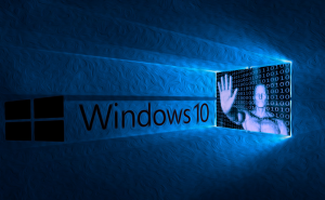
Why does Windows 10 collect your data?
Most of you already know that Windows 10 is keeping tabs on its users collecting loads of data from them, but have you ever wondered why it does that? Here's the answer.
Best Data Analysis Tools in 2022
By instigating Data Analysis Tools, individuals and companies can expedite decision-making, gain new customers, enhance customer experience, and become future-proof.
The GFS backup strategy: never lose your data (again)
The Grandfather-Father-Son backup strategy may feel cumbersome at the outset, but it does the job of keeping your data save. Let's see how it works, and what solution enable it.